Egyed településéről az első okleveles említés 1469-ből származik. Első ismert birtokosa a Mórichidai család volt, a németekkel betelepített falut a középkorban a Festetich majd a Batthyány család birtokolta. A Batthyányiaktól Stern Artúr vásárolta meg a bírtokot 1882-ben, még ebben az évben a régi kastélyt lebontatta és helyére új kastélyt építetett. Stern Artúr nevét Egyedi Artúrra változatta meg. Az új kastély oromzatára Egyedi Artúr a régi kastélyról megmentett Batthyány család címerét helyeztette fel. Az államosítás után iskolát helyeztek el az épület emeletén, a földszinten könyvtár és óvoda kapott helyet 2001-ben az intézményeket kiköltöztették az épületből, majd magán tulajdonba került, azóta üresen áll.

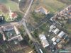
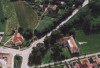
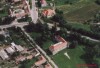
Kísértetkastély Egyeden (Galériához kattintson a képre!)
Fotó: Kisgyörgy Éva
Ugyancsak elhanyagoltan, üresen áll Egyeden a volt Festetics-kastély. Ezt gróf Festetics Károly építtette majorsági központnak, majd később a Batthyány család vásárolta meg. A kastély parkjában volt a hírhedt és Európában is egyedülálló úgynevezett kútbörtön. Annyit sikerült kiderítenem, hogy a 2000-es évek elejéig iskola működött itt, de aztán az anyagi nehézségekkel küzdő önkormányzat magántulajdonba adta. Sajnos le volt zárva, így nem jutottam be, csak az ott legelésző kecskék társaságában sikerült körbesétálnom. |
Address: Egyed, Árpási út 1. |
| Openness for the public: |
 2008:01:20 15:10:23 |
| Data sheet of the garden |
|
| | |
| Garden identificaton number: | 318 |
| Garden name: | Festetics-kastély |
| Present size of the garden: | ha |
| Country: | Hungary |
| County: | Győr-Moson-Sopron |
| Settlement: | Egyed |
| Street: | Árpási út 1. |
| House number: | |
| Phone: | |
| Fax: | |
| Email: | |
| Web site: | http://http://http://http://http://http://http://http:// |
| WGS84 latitude coordinate: | 47.522128 |
| WGS84 longitude coordinate: | 17.338743 |
| National grid X coordinate: | |
| National grid Y coordinate: | |
| Land ownership record: | |
| Owner: | , , , , , , , , |
| Manager(s), renter(s): | , , , , , , , , |
| User: | , |
| Present function, usage: | |
| Openness for the public: | |
| Opening hours: | |
| Visitors per year: | 1990: 1991: 1992: 1993: 1994:
1995: 1996: 1997: 1998: 1999:
2000: 2001: 2002: 2003: 2004:
2005: 2006: 2007: 2008: 2009:
2010: 2011: 2012: 2013: 2014:
2015: 2016: 2017: 2018: 2019:
2020: 2021: 2022: 2023: 2024:
2025: 2026: |
| Garden historical data |
|
| Type: | |
| Style, character: | |
| Special value: | |
| Importance, value: | regional importance |
| Original size of the garden: | ha |
| Year(s) of garden planting: | -
|
| Present state, condition of the garden: | |
| Present structure of the garden: | |
| : | |
| Plant condition: | |
| Plans, maps: | |
| Historic county name: | |
| Historic Monument Data: |
|
| Historic monument number(s): | 9728 |
| Historic monument type: | |
| Resolution of historic monument: | |
| Description of built objects |
|
| Main building description: | |
| Building time of the principal building: | |
| Condition of the principal building: | |
| Present function of the main building: | |
| Other buildings list: | |
| Main building style: | |
| Nature Conservation data: |
|
| Type of nature conservation: | |
| Nature Conservation code : | |
| Natuara2000 area code: | |
| Landscape Data: |
|
| Morphology: | |
| Hydrology: | |
| Plant geography: | |
| Soil: | |
| Climate: | |
| Visual connections: | |
| Landscape Character Area name: | |
| Landscape Character Area type: | |
| | |
| Other: | |
| | |
| Associated persons: | |
| Bibliography: | |
| |
| This page edited by: | kollanyi5, |
| Last modified by: | kollanyi5 2013-11-10 |
|