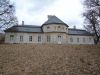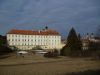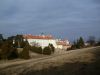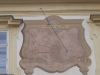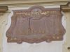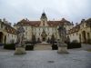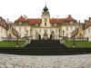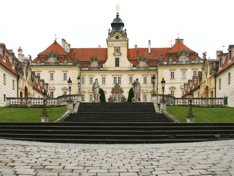
A Valticei kastély a passaui püspök 12. századi várának helyén áll. 1395-ben ezt az uradalmat is megvásárolták a Liechtensteinek, a várat többször átépítették, a 16. században pedig reneszánsz stílusban manierista kastéllyá alakították. A harmincéves háború folyamán a kastélyt súlyosan megrongálták a svéd csapatok. Később a megviselt épületeket teljesen átépítették – a rezidencia így nyerte el mai, barokk alakját. Az átalakítások 1730-ig tartottak, és a kor elsőrangú művészei vettek benne részt, mint J. B. Fischer von Erlach, A. és J. K. Ern, D. Martinelli és mások.
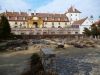
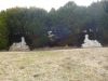
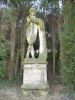
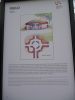
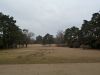
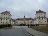
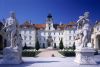
A Liechtensteinek a két kastély (Lednice-Valtice) környékéből az évszázadok során egységes táj-együttes kialakítására törekedtek. Ültettek egy fasort, amely összeköti a két Liechtenstein-székhelyet. A Lednicei kastély épületegyüttesét megtoldották a kora barokk lovarda, Josef Hardtmuth hercegi építész mór stílusú minaretje és a londoni télikert mintájára létesített üvegház pompás épületeivel. A Lednice-Valticei együttes a 19. században, a romantika időszakában kapta végső formáját. Az angolparkban egy sor romantikus építmény született, például az Apolló-templom, a három grácia empire stílusú temploma, és a határkastély az egykori morva-osztrák határon. 1996-ban a Lednice-Valticei együttes felkerült az UNESCO kulturális és természeti világörökségeinek listájára. (forrás: www.czechtourism.com/what-to-see/castles-chateaux/Lednice.aspx?lang=hu-HU) |
Address: Valtice |
| Openness for the public: |
 2012:02:18 14:51:52 |
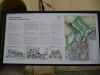
| Data sheet of the garden |
|
| | |
| Garden identificaton number: | 1969 |
| Garden name: | Garden of the chateau Valtice |
| Present size of the garden: | ha |
| Country: | Czech Republic |
| County: | Dél-Morva kerület |
| Settlement: | Valtice |
| Street: | |
| House number: | |
| Phone: | |
| Fax: | |
| Email: | |
| Web site: | www.czechtourism.com/what-to-see/castles-chateaux/Lednice.aspx?lang=hu-HUhttp://http://http://http:// |
| WGS84 latitude coordinate: | 48.738857 |
| WGS84 longitude coordinate: | 16.754408 |
| National grid X coordinate: | |
| National grid Y coordinate: | |
| Land ownership record: | |
| Owner: | , , , , |
| Manager(s), renter(s): | , , , , |
| User: | , |
| Present function, usage: | |
| Openness for the public: | |
| Opening hours: | |
| Visitors per year: | |
| Garden historical data |
|
| Type: | Not selected |
| Style, character: | |
| Special value: | |
| Importance, value: | international importance |
| Original size of the garden: | ha |
| Year(s) of garden planting: | -
|
| Present state, condition of the garden: | |
| Present structure of the garden: | |
| : | |
| Plant condition: | |
| Plans, maps: | |
| Historic county name: | |
| Historic Monument Data: |
|
| Historic monument number(s): | |
| Historic monument type: | |
| Resolution of historic monument: | |
| Description of built objects |
|
| Main building description: | |
| Building time of the principal building: | |
| Condition of the principal building: | |
| Present function of the main building: | |
| Other buildings list: | |
| Main building style: | |
| Nature Conservation data: |
|
| Type of nature conservation: | |
| Nature Conservation code : | |
| Natuara2000 area code: | |
| Landscape Data: |
|
| Morphology: | |
| Hydrology: | |
| Plant geography: | |
| Soil: | |
| Climate: | |
| Visual connections: | |
| Landscape Character Area name: | |
| Landscape Character Area type: | |
| | |
| Other: | |
| | |
| Associated persons: | |
| Bibliography: | |
| |
| This page edited by: | Nagy Nikoletta, |
| Last modified by: | Nagy Nikoletta 2012-02-24 |
|